BIRCHOVER gets its name from references to the birch tree. There are records of the village name being spelt as Barcouereand Birchoure with the modern spelling being recorded in 1265. All of the names refer to a ‘ridge overgrown with birch trees’.
The earliest settlement was originally located at what is now known as Uppertown, about half a mile south and slightly higher up the hill than the modern-day village of Birchover. Restored stocks can be found here.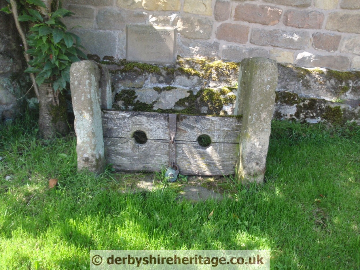
The Saxons were the first to settle here, and the Normans built the first church, but by the Middle Ages the population had outgrown the available water supply and so the whole village moved further down the hill to where the water was more plentiful.
There is no written record of any church at Uppertown but numerous carved and dressed stones, some bearing decorative Norman chevrons can be found in the dry-stone walls which mark the field boundaries. A single reference however, in an ancient Derbyshire Charter dated 1300 states that `a rent of one farthing in silver to be paid yearly on Michaelmas Day in Ye Chapel at Birchover`.
To the east of Birchover is SABINHAY WOOD which dates to Norman times being derived from ‘Sabin’s enclosure’.
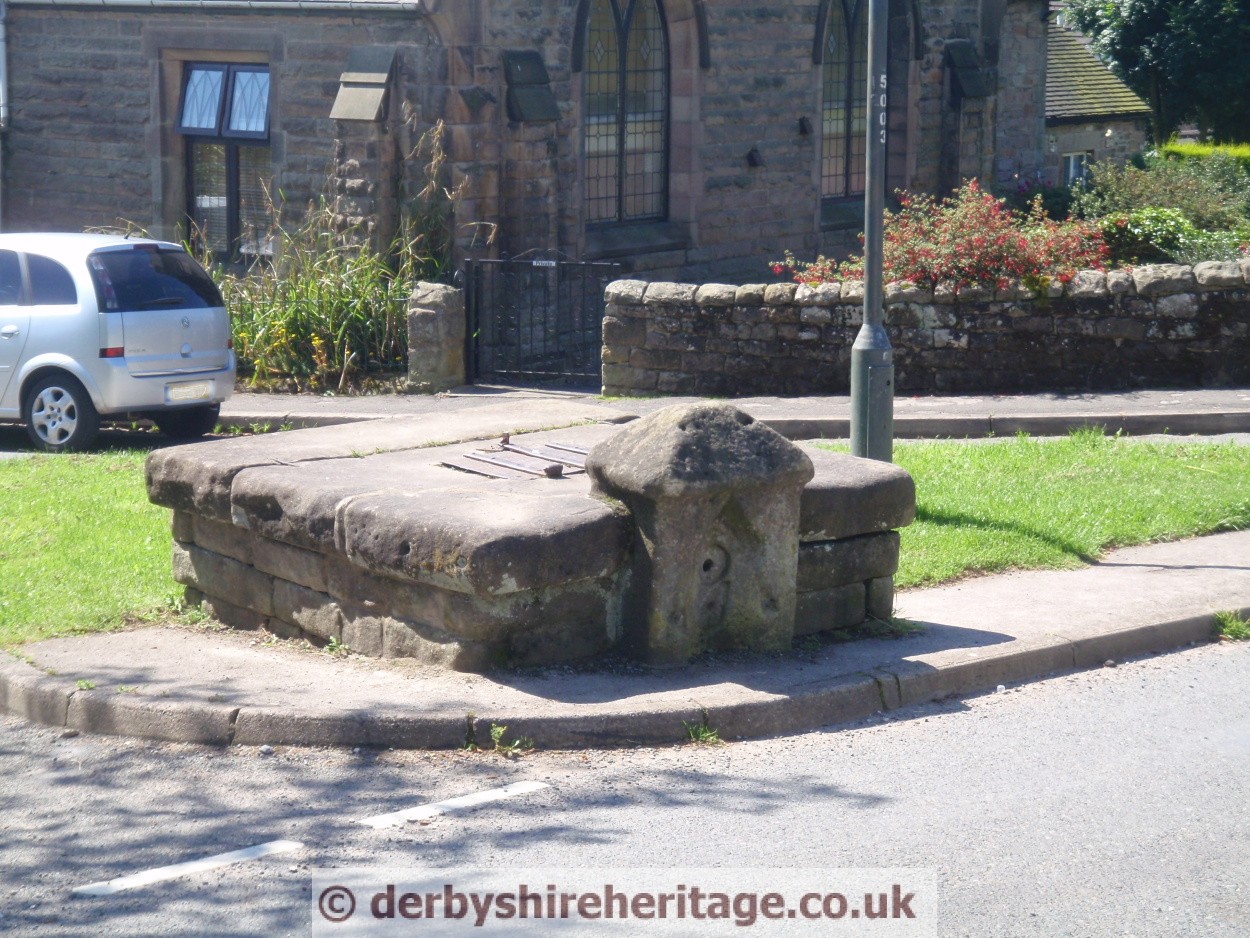
Built in 1680, The Red Lion Inn originally served as a farm and alehouse, gaining its first licence in 1722, when licensing became law. The inn was proposed for sale in April, 1884, for £285. The property then consisted of “Houseplace and parlour, kitchen cellar etc., two bedrooms and large club room, together with cowhouse and stable, gardens and appurtenances”. Also included was a coach-house and a piggery across the road. When it was built in the 17th century, the inn consisted only of the “houseplace”, now the lounge, and bar above the 30 feet deep well, which lies below a thick glass cover in the main entrance. The coach house and piggery have long since gone but their location is now marked by the stone covered tank and pump which was the village water supply.
On the same road is also a cottage with an unusual porch constructed from Pulp Rollers and a little further down is the site of the village Pinfold.
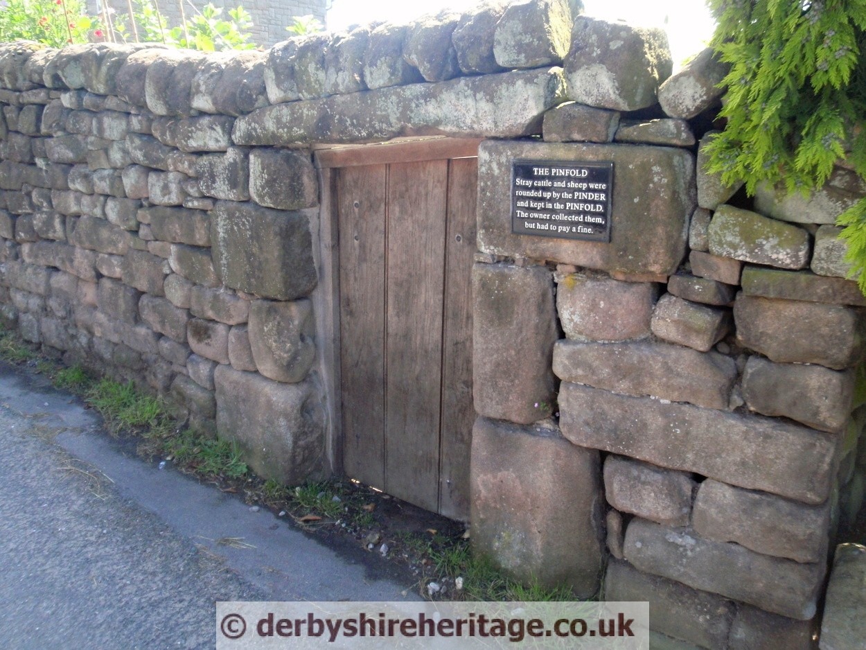
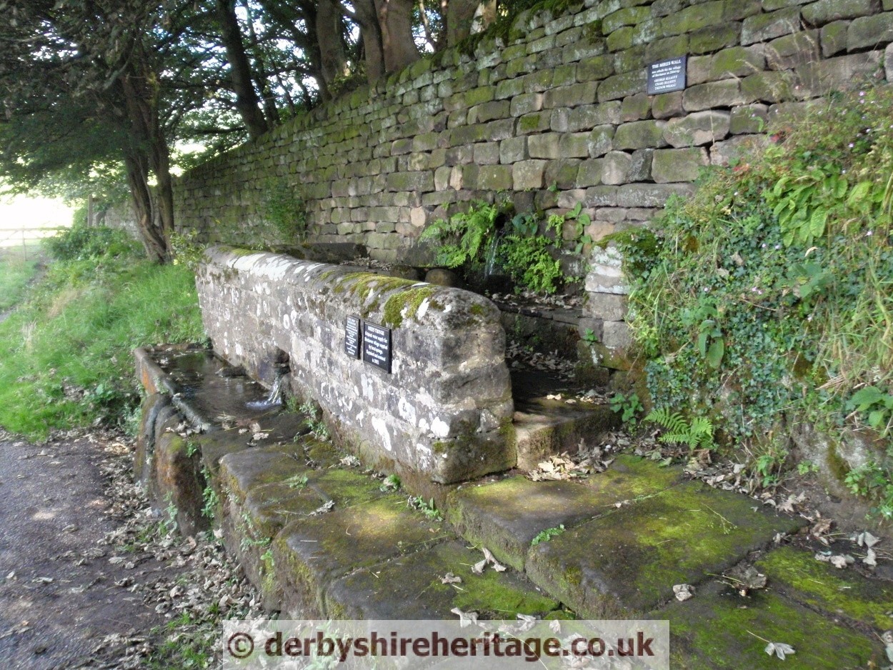
On the road up to Birchover is the Mires Trough which was also the village water supply at one time.
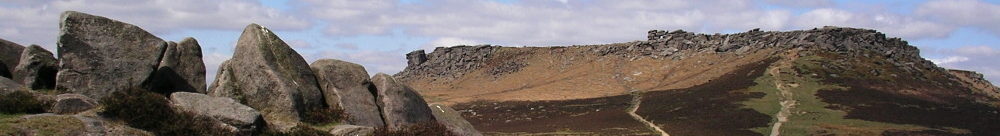
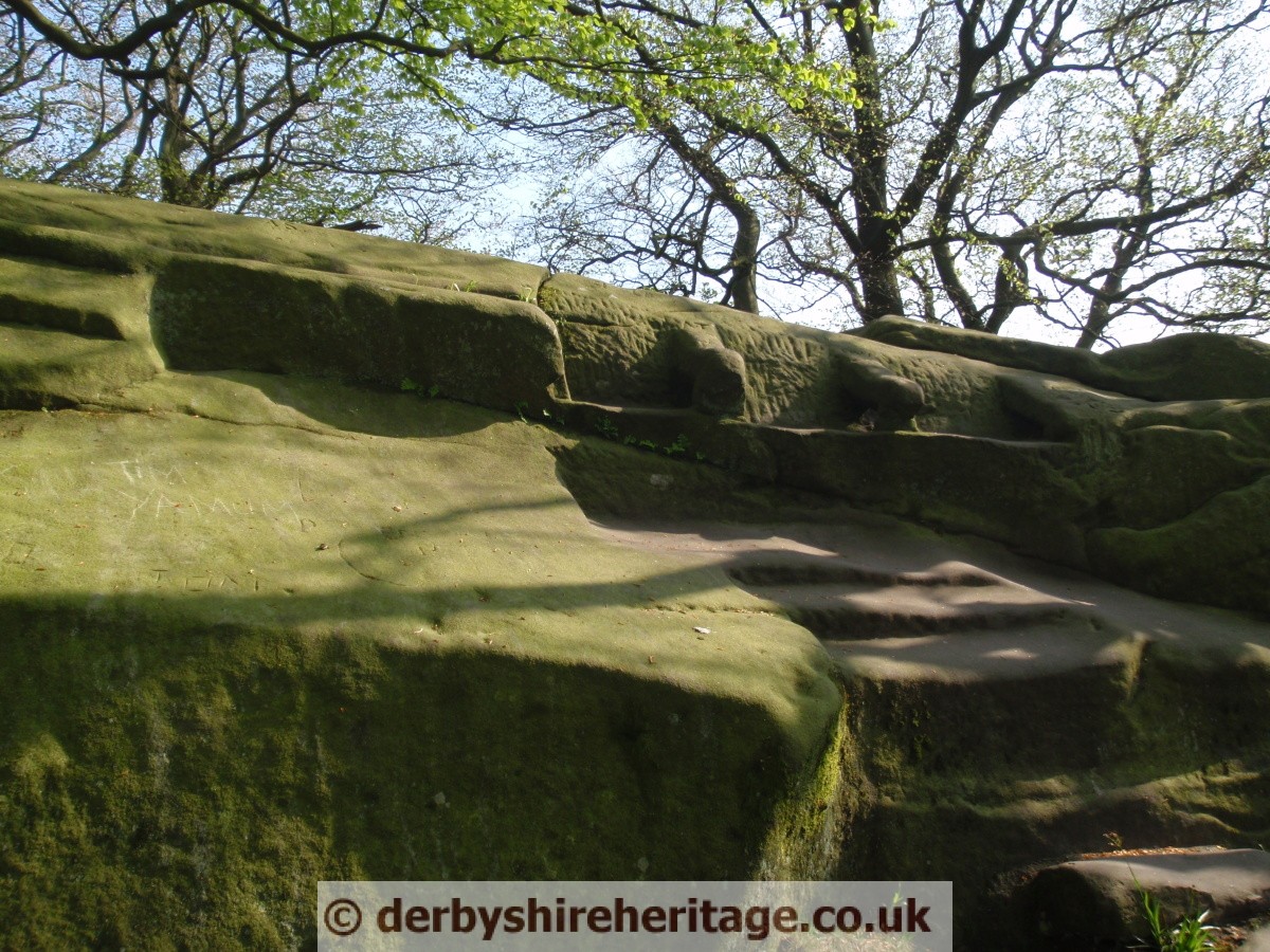
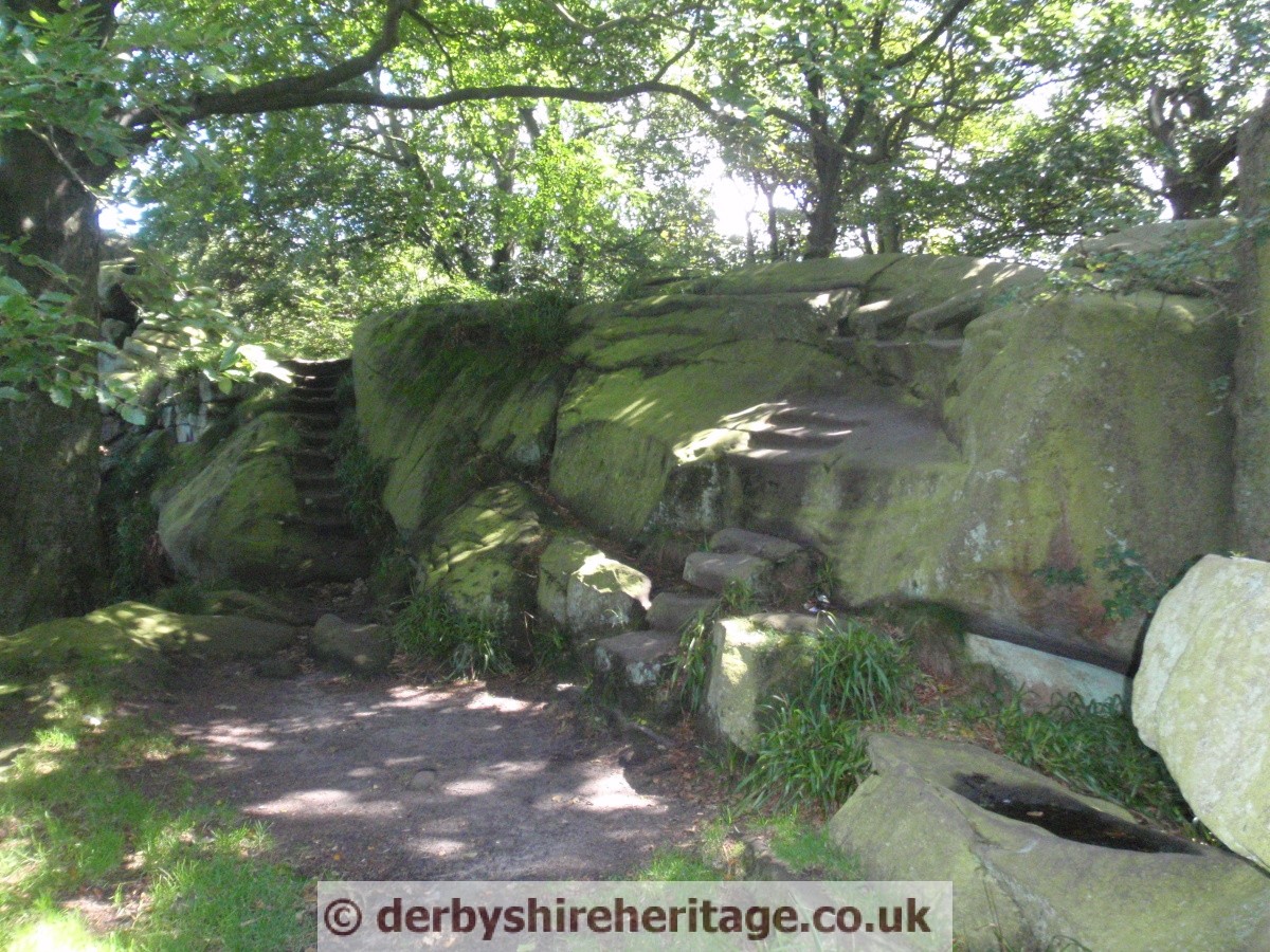
Rowtor Rocks was explained to Victorian sightseers as an ancient Druid stronghold but the only local connection with Druids was the Druid Inn which was a meeting place for the Ancient Order of Druids, a friendly society founded in 1781.
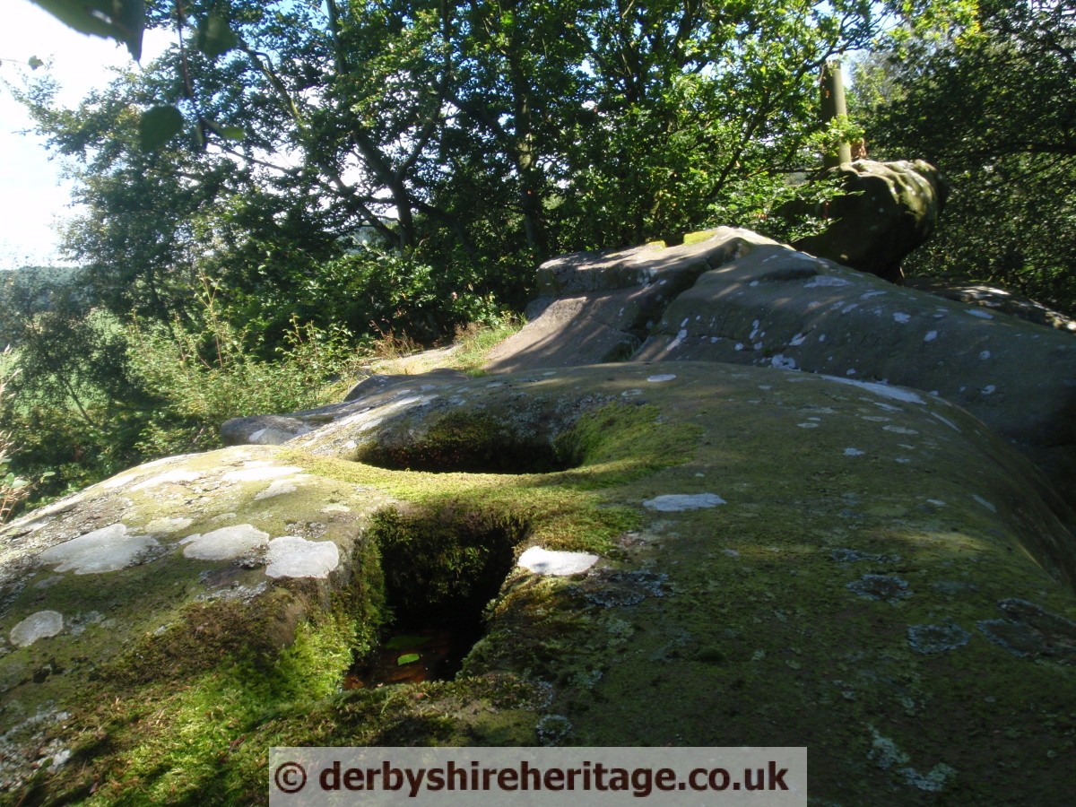
Carved in and through the gritstone of Rowtor Rocks are caves, rooms, alcoves, tunnels, flights of worn stone steps, a stone armchair, a square font, cup and ring markings, rock basins and square sockets which may have supported crosses.
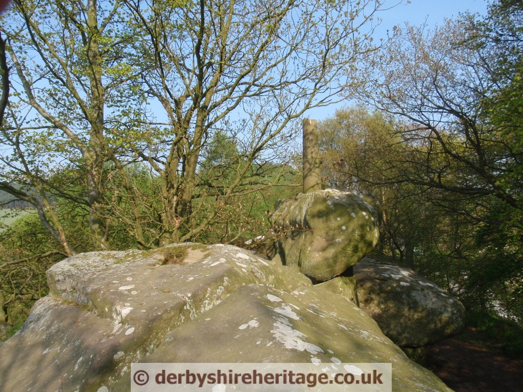
The views are now obscured by trees but nevertheless still impressive.
All of this extensive sculpting was the work of local parson Thomas Eyre three centuries ago.
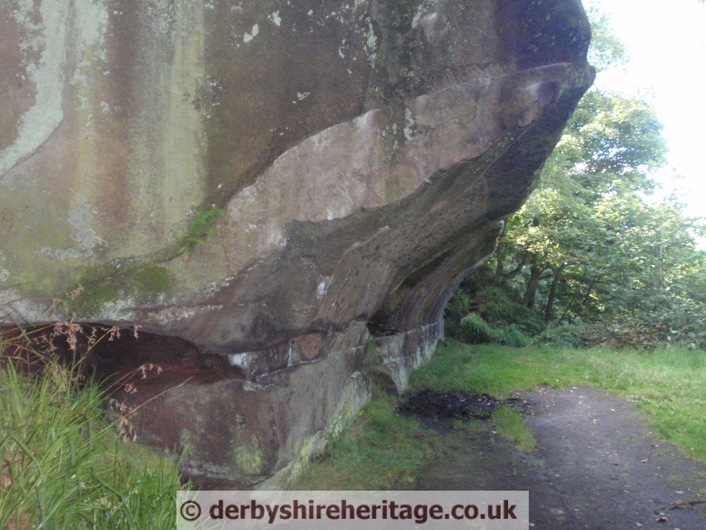
At the eastern edge of the eighty yard gritstone ridge was a large rocking stone, weighing an estimated 50 tons, which could be moved by hand until, it is said that on Whit Sunday 1799 a gang of 14 young people pushed the stone off its pivot. The stone was replaced but the original balance could not be restored.

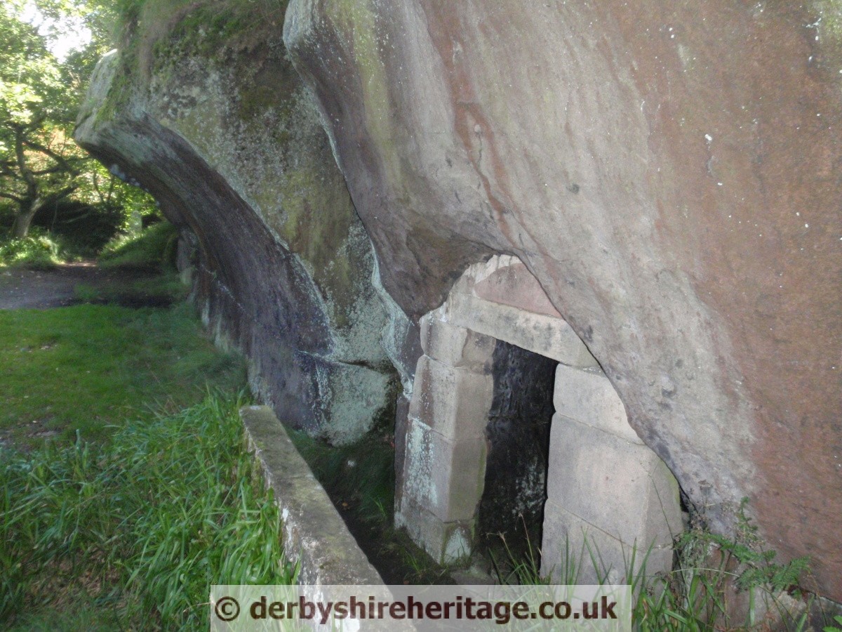

There is another Curiosity not so far away.
The Cratcliffe Hermitage in Cratcliffe Rocks.
At the base of Cratcliffe Rocks on the western side is Hermit’s Cave. The Hermit’s Cave with a four feet high crudely carved crucifixion on the wall and a niche for a lamp or candle by its side probably dates to the 14th century.