Curbar until 1921 was part of the Duke of Rutland’s estate.
Early records of the name Curbar include Cordeburg in 1203, Cordesburwe in 1285, Quordborough in 1346, Cordborgh in 1356, Corburg in 1365, Coresburgh in 1423 and Corber in 1577. All translate to originally being ‘Corda’s fortified place’. The personal name is not absolutely certain as a number of possible names would fit.
The village developed at a crossing point of the river Derwent and the pack horse trade route between Sheffield and Manchester. The route from The Bridge Inn up to Curbar Gap was originally a Roman road leading up the incline towards Curbar Edge. Evidence of later use as a recognised track is shown by the guidestoop at Curber Gap. In 1759 the road was turnpiked.
From Curbar Parish Council website – In 1891 there were 336 inhabitants. In 1895 there were 16 farms. Today there are no working farms and still only 360 inhabitants. In 1927 the Duke of Rutland sold the tenanted village at a public auction in Bakewell. Most of the tenants bought their own properties and family descendants still own several of them and the associates small holding lots of land either side of the road.
All Saints Church: This Anglican church was built in 1868 on land made available by the Duke of Rutland. The school followed in 1871 with an adjacent house built for the schoolmaster.
Kelly’s Directory of 1932 describes Curbar as a township and small village, 5 miles north-east from Bakewell and 3 from Grindleford station, on the Dore and Chinley section of the London, Midland and Scottish railway. The ecclesiastical parish was formed in 1869 from that of Baslow, St Anne, and includes the townships of Calver and Froggatt.
The church of All Saints was said to be built in 1867, and “a small edifice of stone in the Early English style, consisting of chancel, nave of three bays, south aisle, south porch, and a small western turret containing one bell”. There are 350 sittings.
The parish records date from 1868. The living was then a vicarage, in the gift of the vicar of Baslow, and had been held since 1931 by the Rev. Arthur G. Kirby M.A. of Keble College, Oxford.
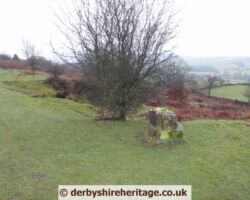
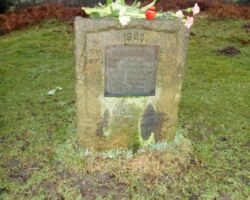
The Bible Stones. Between Curbar Gap and Curbar village there are some interesting carved stones to be found close to the roadside, which have biblical references on them. This was done in the 19th century by Edwin Gregory who was a mole catcher for the Duke of Devonshire. He was a devout Wesleyan and evidently so grateful to recover from a serious illness that he carved on the stones as a form of thanksgiving.
The Plague came to Curbar before it reached Eyam with tombs dated 1632 evident in several parts of the village.
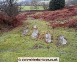
The Cundy family, local farmers, died of the plague in 1632 this is 30 years before the Plague village of Eyam was hit. Each of the grave slabs have their initials carved into them.
The Cundy family were from nearby Grislowfield Farm. It is not known who buried the family but Thomas and Ada Cundy together with their children Olive, Nellie and young Thomas each have a slab carved with their initials. Other Curbar plaque tombs can be found below the Wesleyan Reform Chapel further down the village.
Grislow Field is derived from the Saxon describing ‘gristly open land’. The area is not very good agriculturally as it has only a thin layer of soil and is very rocky.
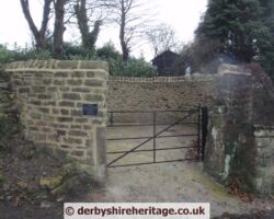
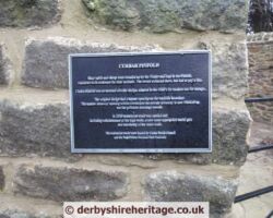
Curbar pinfold is located on the south side of the steep hill up from the River Derwent – it was restored in 2010. These were built to hold animals which had been found straying from their owner’s land or grazing on the common without common rights. The animals were driven into the pinfold and kept there at the expense of the owner until a fine was paid.
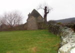
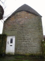
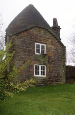
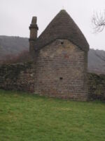
Curbar lockup is unique 18th century building, built around 1780, with an unusual conical-shaped roof. It stands alone in the corner of a field not far from the Cundy Graves north east of Lane Farm. It has just two rooms one up one down. A chimney was built in later years for a fireplace on the ground floor when it was converted into a dwelling and is said to have been inhabited until just prior to the Second World War.
A lot of its history is open to conjecture and is mostly derived from word of mouth although it does appear that the windows have been barred.
As a lock-up is it reputed to have been used to keep prisoners overnight whilst in transit to other gaols or court hearings.
In the Civil War prisoners were said to have been held in the lockup prior to being transported to Sheffield gaol and Sheffield Assizes.
One local tradition says that was used as a pest house. Pest Houses were commonly-owned buildings on the fringes of villages where those struck down with the plague or other infectious ailments could be re-housed until the illness took its course and they either recovered or died. An early form of quarantine really and for Curbar this would have been the ideal spot. Close enough to keep an eye on but far enough away from the main body of the population to avoid contagion. Since it was built around 1780 then it is unlikely that it would have been used to house bubonic plague sufferers but could have taken anyone suffering from a number of ailments which fortunately we don’t see very often today such as leprosy or cholera.
It is known that it was used as domestic accommodation. A sailor known as Francis Pelly lived here and a local deaf-mute named Ebenezer Barratt, known locally as Yebby was the last permanent resident.
In the Civil War prisoners were held in the Curbar lockup prior to being taken to Sheffield gaol.
The property acquired a chimney in later years when it was converted into a dwelling and is said to have been inhabited until just prior to the Second World War.
The building was condemned as unfit for habitation in 1935.
It is a Grade II listed building – from British Listed Buildings –
Description: Lock-up 250 Yards North East of Lane Farm
Grade: II
Date Listed: 12 July 1967
English Heritage Building ID: 81536
Lock-up. Late C18. Coursed rubble gritstone with a conical roof of stepped
squared masonry on a square ground floor base. Single bay, two storeys, with
a plain doorway with massive surround to the south with plain surrounds. North east
elevation has external ashlar stack with stone chimney pot.

